

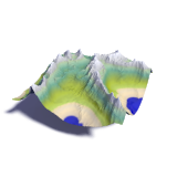
generalization and map rendering demo
This map demonstrates cartographic generalization techniques applied to web map rendering. Generalization of the coastlines is done using the coastline_gen tool.
A more detailed explanation on the importance of generalization in map rendering can be found in my essay on coastline generalization. Also available is a description of the process of generalizing rivers and lakes.
If you want to render your own maps using a generalized coastline you can download a set of coastline vectors for zoom levels 1 to 8 based on OpenStreetMap data.
Other map projections: web mercator antarctic
Using data from:
OpenStreetMap contributors (ODbL),
viewfinderpanoramas.org,
NASA,
GLFC,
NOAA,
NSIDC,
CanVec,
tiles CC-BY-SA
– find out more

Visitor comments:
By submitting your comment you agree to the privacy policy and agree to the information you provide (except for the email address) to be published on this website.