August 2015 update on the state of glacier mapping in OpenStreetMap
This is an update on my analysis of the state of glacier mapping in OpenStreetMap. It gives a quick look over what has changed in terms of glacier data in OpenStreetMap since end of 2013.
Recent changes in the OpenStreetMap glacier data
As explained in the original analysis not many mappers are engaged in glacier mapping in OSM but in nearly two years still quite a few things have happened:
- Some new import based glacier data in Norway - still patchy.
- First small attempts at glacier mapping in Svalbard.
- Russian Arctic islands are now complete with Severnaya Zemlya and De Long islands.
- Quite a lot of new glacier mapping in Nepal (where there are a real lot of glaciers to map).
- A few local additions all over Asia - Turkey, Mongolia, Tibet and Russia.
- Some more imports in Canada (but fairly outdated), in addition partial mapping of Labrador glaciers.
- Alaska: primarily on the Aleutian islands, based on old USGS maps.
- Heard Island and Bouvet Island are now mapped, some limited and fairly crude mapping on South Georgia
- Quite a lot of improvements in South America although the far south is still fairly bad.
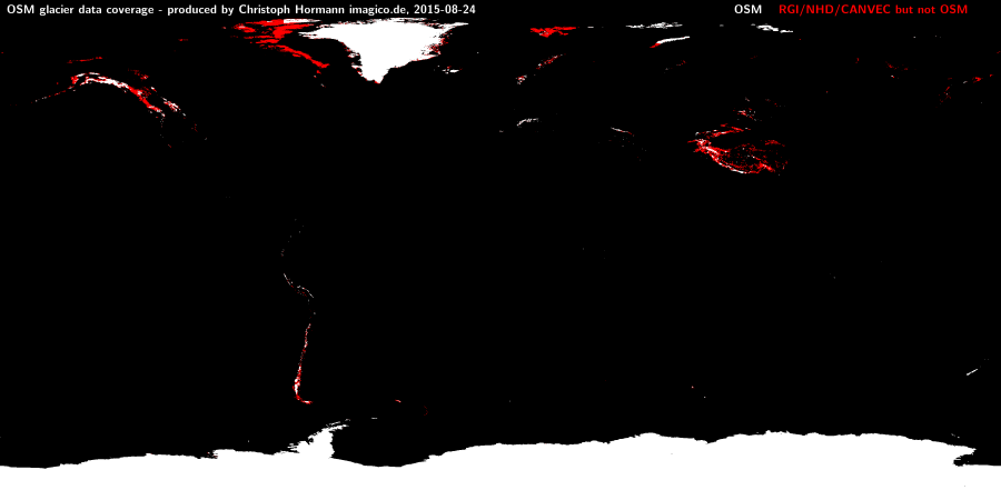
As you can see on the last map below the most serious gaps in glacier mapping are now in Northern Canada, Svalbard and the Himalaya-Tibet region.
Updated quality analysis maps
See the original report for more detailed explanations on these.
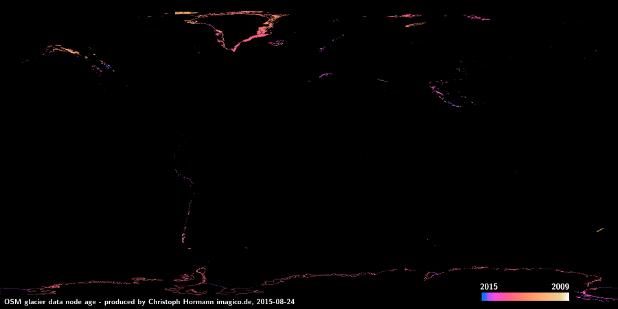
The age of nodes of the glacier data:
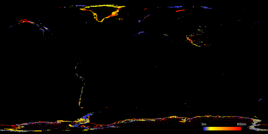
The average distance of nodes:
Where OSM lacks glacier mapping in comparison to other data sets (red) and where it contains glacier data (white):
Christoph Hormann, August 2015


Visitor comments:
no comments yet.
By submitting your comment you agree to the privacy policy and agree to the information you provide (except for the email address) to be published on this website.